Thursday, March 25, 2021

Fairbanks to Barrow

Looking on the map around from Fairbanks, for someplace interesting to fly, I found Wiley Post - Will Rogers airport in Barrow, on the North coast of Alaska, a 442 NM flight. This airport is named for the two famous men who died in a plane crash near Point Barrow. Here's that story, from the Smithsonian Air and Space Museum: Wiley Post had become close with Will Rogers after his 1931 around-the-world flight. Rogers was an ardent aviation enthusiast and frequently sang Post’s praises in his newspaper column. In 1935, Post suggested a flying getaway to Rogers who was under considerable pressure from his newspaper editor and Hollywood agent to maintain his previous output. Rogers jumped at the opportunity. By this time, the Lockheed Vega "Winnie Mae" was largely obsolete and worn out. Post had replaced it with a new aircraft which combined a Lockheed Orion fuselage mated with wings from a different model Lockheed aircraft – an Explorer. As Post was not an aeronautical engineer, the combination was potentially hazardous and he made it more so by adding floats from a larger Fokker aircraft. This made the aircraft dangerously nose-heavy. Nonetheless, Post and Rogers set off to explore Alaska and Russia. The aircraft performed adequately at first, but the engine sputtered while taking off from a small lake in the tundra near Point Barrow and Post could not recover. Both men were killed when the plane struck the water and flipped. An investigation raised serious questions about Post’s decision to cobble together major parts of his aircraft from different models. Supposition centered on engine problems possibly brought on by carburetor icing and an insufficient amount of elevator surface to counteract the nose heavy loading of the aircraft in a glide.

I "jumped in" the X-Plane simulator before sunrise, fired up my favorite little SF-50 jet, and checked the ASOS. Considering all the high mountains in Alaska, I decided to plan my route to follow the standard IFR airways. That would give me specific minimum altitudes to fly, especially during my descent, and guarantee clearance from the terrain. My route would take me to Fairbanks VOR (FAI), then via airway V444 to Bettles VOR (BTT), then Barrow VOR (BRW), from which I would fly the RNAV/GPS approach to runway 07 into Post-Rogers airport. With good weather in the forecast, an instrument approach wouldn't be necessary, but it's nice to have the extra guidance, when flying into a new-to-me airport.

Taxiing out in the dark can be a challenge at a major airport, but Fairbanks isn't that big, and it's nicely laid out, so finding the end of runway 02 wasn't a problem. Here I am, lined up for takeoff on runway 02.

Climbing to 31,000 feet, my cruising altitude for the trip to Barrow, with the sunrise starting to light up the horizon. 


Level at 31,000 feet, almost to Bettles VOR, and about a third of the way to Barrow.
Starting my descent from cruise altitude, with the morning sun behind me.

Descending through 14,000 feet, with the RNAV/GPS approach to runway 02 (FEFTU transition) setup in the Garmin G3000 flight deck. 


The RNAV-07 approach calls for a descent to 2,000 feet within 30NM of the FEFTU Initial Approach Fix (IAF) waypoint, then one or more laps in the holding pattern as necessary, until established at 2,000 feet at OBCIN, then a descent to 1,700 feet until the WANJO Final Approach Fix (FAF), then a descent to 302 feet until reaching the missed approach point (MAP) 0.9 miles before the airport. As usual, I'm planning a final approach speed of 90 Knots with full flaps, which should take about 40 seconds to cover 1 Nautical Mile with no wind, or 2 minutes and 40 seconds to get from WANJO to the MAP.


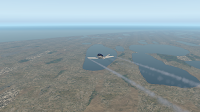
Passing over a field of many lakes on the peninsula that holds Itqiagvik. Just need to fly a few more miles out over the Artic Ocean, and then the right turn onto final approach for runway 07 at Post-Rogers airport. 


The Foreflight app provides a highly capable aircraft-independent moving map display and horizontal situational awareness. This is handy for continuity, when jumping around between airplanes, and is an awesome backup for the one in the airplane. However, the Garmin flight deck mounted in the plane is the official reference.


Flying over the Artic Ocean (!), after the right turn onto the final approach to runway 07,with Post-Rogers airport straight ahead. 


On the ground at Barrow airport! Not a lot to see here - just a few support buildings on the airport.

Sunday, March 21, 2021

Yakutat to Fairbanks

Today's flight is from Yakutat, Alaska to Fairbanks, a flight of 412 Nautical Miles, that should take the Cirrus SF-50G2 Vision Jet about 1 hour and 40 minutes. There are some significantly high mountains along the way. I've chosen a course that takes me direct to Northway VORTAC (ORT), then Big Delta VORTAC (BIG), and then to Fairbanks (PAFA). The last two legs are on the instrument airway T232, that has published minimum enroute altitudes, which will help me avoid terrain while descending into Fairbanks. I'll be on my own, for avoiding terrain while climbing to ORT, and there are some seriously high mountains along the way, so I'll use the terrain mapping capabilities of the Garmin 3000 to help me with that.

My first screenshot is on the ground at Yakutat, after starting the engine, with full fuel tanks, and the trip and autopilot information entered into the Garmin G3000. I've zoomed in on the map display, to show the airport layout, which will help me find my way safely through the inky early morning dark, to the runway I've chosen for departure.


Using runway 11 as a taxiway, to get to my departure runway 20. With the winds calm, and no local traffic or ATC service this early, I had my pick of any runway. Since the southwest runway 20 was so close,I chose to get airborne sooner, even through I'll be pointed somewhat away from my destination at first, since it will give me a little more time to get above surrounding hills, as I turn on course while climbing.


Lined up and ready for takeoff on runway 20. By taking off in this southwest direction, I'll have long sweeping right turn to get on my planned course of


Climbing through 400 feet, and starting a turn to the right, towards the programmed track to Fairbanks. Notice the large red area to my right, about 25 NM away, which is terrain at or above my altitude, that I will need to be above, by the time I get there.
Intersecting my planned course, while climbing through 1,360 feet, with all that high terrain now directly ahead, and still above me.


Now on course and climbing through 9,000 feet, with the red areas greatly reduced, which indicates that I'm now above a lot of the terrain. I still need to get above one large red area directly ahead, which should be no problem, as it's still about 50 miles away.


Climbing through 12,100 feet, and there is still one persistent red area about 45 miles directly ahead. Must be a high mountain peak.

Climbing through 17,170 feet, and that high mountain peak is still looming, about 40 miles ahead. That's a tall hill! Taller than any mountains in the contiguous USA, all of which top out at or below Mt Whitney's 14,505 feet. Now that this one is shown as a very small red area, it's much less of a concern, since I'll have plenty of room to navigate around it as necessary, but it's likely this is the tip of a tall mountain, and I'll be completely above it soon. 


There's often not much to see, when flying at night, but as the morning light begins to make things visible outside, it becomes apparent that I'm climbing over a layer of clouds, with a few mountain peaks poking up through the cloud layer. 
Climbing through 19,660 feet, and that mountaintop ahead is still showing up as a terrain warning, but now it's yellow, which indicates it's slightly (between 100-1000 feet) below me.


And here's that big 19,551 foot mountain, Mount Logan, that I was watching so closely earlier. It still looks big, especially with the naked eye, but with my altitude at 22,980 feet and climbing, it's no longer a concern to me.

The eastern horizon is starting to light up a little, at 6:30am local time.


One last look at Mt Logan, 7 miles ahead, as I cross that ridge, while climbing through 27,000 feet.


Level at 31,000 feet, with 192 miles to go. I zoomed out on the map display as far as it would go, and can now see the rest of my planned route, all the way to Fairbanks.


Here's a different view angle on the Vision Jet's instrument panel. I rarely use any of the three smaller displays, since they're not very functional in the X-Plane simulator. The left one manages the audio for the radios, and I use it once or twice a flight, to monitor the COM2 radio, when I'm listening to the ATIS of my departure or destination airport. The center one manages the autothrottle, which isn't well simulated, so I don't use it at all. The right one shows landing gear and brake status, and has the de-icing controls, so it can be pretty handy at specific times.The small control panel below has all the autopilot controls, which I use for pretty much every flight.


Pretty sunrise at 6:56am local time.

Level at 31,000 feet, and 60 miles from the Northway (ORT) VOR. 

And suddenly, in real life, we were ready to head out to pick up breakfast ;-) so here is where I saved my flight and shutdown the simulator, as it turns out, for the next three days...


Resuming this flight three days later... the simulator took a few seconds to reaquaint itself with the situation... and I see the cloud layer is a little thicker today...
So I got to experience the beginning of sunrise again, from 31,000 feet...and then it was time to head out for breakfast again... but this time, I was back to resume the flight, a few hours after we finished breakfast...

Descending through 11,400 toward an undercast layer, with the Fairbanks ASOS frequency 124.4 tuned into the COM2 radio. It's nice, if less realistic, that X-Plane displays the ASOS information at the top of the screen, while it's also playing the audio over the speaker. The Garmin 3000 is setup with the ILS instrument approach to runway 02L, with the GLOWS transition. This requires me to cross GLOWS intersection, fly heading 343 degrees, intercept the localizer at or above 2,600 feet, and follow the ILS to the airport, with a decision height of 639 feet. 


The clouds are so clean and bright white, as I approach the top of the undercast layer...
...and now I'm into the clouds, at aIround 6,500 feet...

With the outside temperature at -21 degrees C, and visible moisture in the form of clouds, I know there's a good chance I'm picking up some ice on the airframe. The X-Plane simulator does a pretty good job of simulating loss of performance due to ice buildup, but I can't really see it like I would in the real airplane. So my way of checking, is to bring up an X-Plane specific data output window, with icing information in it. And yes, I now see that I'm picking up a trace of ice on the wings, angle of attack (AOA) vane, and window. It's hard to see the ice on the window, with the clouds the same color. Anyway, now seems like a good time to activate the de-icing equipment!


Breaking out of the cloud layer, while descending through 5,800 feet. It's still very moist below the clouds, with a corresponding reduction in visibility.
The view from outside, in this thick moist air, shows that the ground is perhaps barely visible, even though the visibility is much better than it was in the cloud layer.

Descending through 4,800 feet just before GLOWS intersection, and preparing to turn right onto the intercept course toward the ILS localizer.


Established on the ILS localizer inbound course, level at 2,100 feet, and watching for the glideslope intercept. Visibility's plenty good to see the airport when I get close.


Descending through 1,680 feet, after intersecting the glideslope, with the airport visibile 3.5 miles ahead.

Short final for runway 02L.


The little Vision jet looks cold and lonely from this angle, parked in a quiet corner, and ready to shutdown the engine.