Looking on the map around from Fairbanks, for someplace interesting to fly, I found Wiley Post - Will Rogers airport in Barrow, on the North coast of Alaska, a 442 NM flight. This airport is named for the two famous men who died in a plane crash near Point Barrow. Here's that story, from the Smithsonian Air and Space Museum: Wiley Post had become close with Will Rogers after his 1931 around-the-world flight. Rogers was an ardent aviation enthusiast and frequently sang Post’s praises in his newspaper column. In 1935, Post suggested a flying getaway to Rogers who was under considerable pressure from his newspaper editor and Hollywood agent to maintain his previous output. Rogers jumped at the opportunity. By this time, the Lockheed Vega "Winnie Mae" was largely obsolete and worn out. Post had replaced it with a new aircraft which combined a Lockheed Orion fuselage mated with wings from a different model Lockheed aircraft – an Explorer. As Post was not an aeronautical engineer, the combination was potentially hazardous and he made it more so by adding floats from a larger Fokker aircraft. This made the aircraft dangerously nose-heavy. Nonetheless, Post and Rogers set off to explore Alaska and Russia. The aircraft performed adequately at first, but the engine sputtered while taking off from a small lake in the tundra near Point Barrow and Post could not recover. Both men were killed when the plane struck the water and flipped. An investigation raised serious questions about Post’s decision to cobble together major parts of his aircraft from different models. Supposition centered on engine problems possibly brought on by carburetor icing and an insufficient amount of elevator surface to counteract the nose heavy loading of the aircraft in a glide.
I "jumped in" the X-Plane simulator before sunrise, fired up my favorite little SF-50 jet, and checked the ASOS. Considering all the high mountains in Alaska, I decided to plan my route to follow the standard IFR airways. That would give me specific minimum altitudes to fly, especially during my descent, and guarantee clearance from the terrain. My route would take me to Fairbanks VOR (FAI), then via airway V444 to Bettles VOR (BTT), then Barrow VOR (BRW), from which I would fly the RNAV/GPS approach to runway 07 into Post-Rogers airport. With good weather in the forecast, an instrument approach wouldn't be necessary, but it's nice to have the extra guidance, when flying into a new-to-me airport.Taxiing out in the dark can be a challenge at a major airport, but Fairbanks isn't that big, and it's nicely laid out, so finding the end of runway 02 wasn't a problem. Here I am, lined up for takeoff on runway 02.
Climbing to 31,000 feet, my cruising altitude for the trip to Barrow, with the sunrise starting to light up the horizon.
Descending through 14,000 feet, with the RNAV/GPS approach to runway 02 (FEFTU transition) setup in the Garmin G3000 flight deck.
The RNAV-07 approach calls for a descent to 2,000 feet within 30NM of the FEFTU Initial Approach Fix (IAF) waypoint, then one or more laps in the holding pattern as necessary, until established at 2,000 feet at OBCIN, then a descent to 1,700 feet until the WANJO Final Approach Fix (FAF), then a descent to 302 feet until reaching the missed approach point (MAP) 0.9 miles before the airport. As usual, I'm planning a final approach speed of 90 Knots with full flaps, which should take about 40 seconds to cover 1 Nautical Mile with no wind, or 2 minutes and 40 seconds to get from WANJO to the MAP.
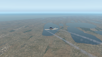
Passing over a field of many lakes on the peninsula that holds Itqiagvik. Just need to fly a few more miles out over the Artic Ocean, and then the right turn onto final approach for runway 07 at Post-Rogers airport.
The Foreflight app provides a highly capable aircraft-independent moving map display and horizontal situational awareness. This is handy for continuity, when jumping around between airplanes, and is an awesome backup for the one in the airplane. However, the Garmin flight deck mounted in the plane is the official reference.
Flying over the Artic Ocean (!), after the right turn onto the final approach to runway 07,with Post-Rogers airport straight ahead.
On the ground at Barrow airport! Not a lot to see here - just a few support buildings on the airport.


No comments:
Post a Comment