Heading from Barrow to Talkeetna, Alaska this morning! I've been hearing about Talkeetna for a long time. It started with me reading a book titled "Wager With The Wind: The Don Sheldon Story," while we were visiting with Kristan's cousins, at their Lake Tahoe house in King's Beach. Uncle John walked by, and noticed the book title, and mentioned that he'd flown his Comanche up to Alaska with his friend, and met Don Sheldon, when they landed at Talkeetna airport, to take refuge from being squeezed between low clouds and high trees.
On the ground at Wiley Post - Will Rogers airport in Barrow, Alaska, and ready to start the engine. It's cold (-20C) with strong winds (050 degrees at 24 knots), and some blowing snow this morning.
Listening to the automated surface observation system (ASOS), while making sure my planned flight is programmed into the Garmin 3000. I'm planning a direct flight, which also happens to follow the low altitude airway T242, that runs from Barrow VOR to Talkeetna VOR. How convenient. The minimum enroute altitude (MEA) for this airway is 16,000 feet, due to mountain ranges along the way. I'll be cruising at 31,000 feet, so my only concern is getting high fast, and not coming down too quickly before my destination.
Lined up for takeoff on runway 05. This gives me a 20 degree left crosswind, which isn't bad. I realized as I was applying takeoff power, that I'd forgotten to select the first notch of flaps, so I did that before I released the brakes. That's not a great idea, but would've been more easily handled by this little straight-wing jet.
Climbing out from Barrow. The simulator lets me look at the airplane from outside, which is a cool way to double-check that I've got the plane configured cleanly for the climb, with gear and flaps up. There's a relatively low layer of broken clouds that I'm just getting above.
Climbing above the broken cloud layer, after turning onto my southbound course, with Post-Rogers airport directly behind me.
Leaving Alaska's north coast behind me, as I continue my climb southbound. And here's where I paused the simulator, and saved my flight, so we could start making breakfast.
The day kind of got away from me, and I didn't resume this flight until the next morning. So here we are, after an uneventful cruise at 31,000 feet, descending through 23,400 feet, flying toward the POLYC transition waypoint for the RNAV-19 instrument approach to Talkeetna airport.
Crossed POLYC and on our way to the EHZEG waypoint, planning to cross it at 11,100 feet.
It's too dark to see much out there, on this early morning flight. I can just make out a cloud layer to the left and below.
Listening to the Talkeetna ASOS, while descending through 13,500 feet, on the RNAV-19 initial approach segment.
Looking ahead and right, to the support buildings near the aircraft tiedown area.
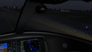
Looking for a nice quiet tiedown spot, out of the way of the hustle and bustle of ground traffic at this little airport.
All settled at my parking spot, and preparing to shutdown, with my next flight programmed into the Garmin 3000. I've decided my next leg of this adventure, will be to head to Fort Simpson in the Northwest Territories.
With the aircraft shutdown, all is quiet inside, and the airport is just waking up, in the early morning dewy haze.


No comments:
Post a Comment